Phone : 0800 470 3410
Phone : 0800 470 3410
by Charlotte Smith, Flood Assets Officer –
to download case study as a PDF click here
Essex County Council’s Flood and Water Management Team implemented the STM Flood Risk Data Management System in July 2015. Having STM in place has reduced our research time when dealing with enquiries and applications, therefore increasing our turnaround, providing a better customer experience, as well as increasing our savings through better use of team resources and more joined up working.
As the LLFA, Essex County Council has a role in overseeing the management of local flood risk including; ground water, surface water and ordinary watercourses. As such we have to collate and manage a large amount of data, much of it sourced from different stakeholders across the county. We receive enquiries from members of the public regarding flooding incidents, undertake flood risk enforcement activities, deal with land drainage consent applications and are a statutory consultee on planning applications.
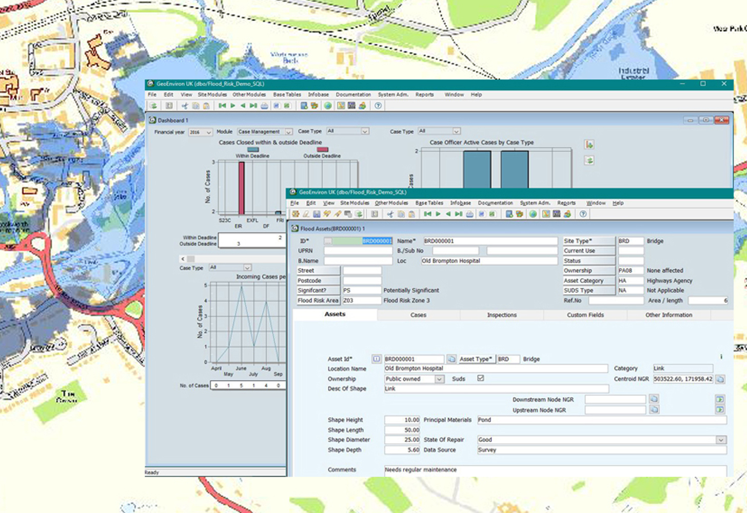
Before implementing STM, we managed our flood risk data using a programme which was originally set up for our highways department. This programme was wholly unsuited to the job; it was unable to map sites off of the adopted highway area and did not have a way of managing flood assets. With our asset register ever expanding and the increased pressures on our team, this seemed like the right time to upgrade to a system that was specifically designed for flood management.
Our team of 13, which includes four development and flood risk officers and several watercourse engineers, all use the STM system daily to manage enquiries, map and manage flood assets. The process of responding to a customer is much the same as before we had STM, however we are now using one piece of software which can hold all of our team data allowing for much easier joined up working.
The system has reduced the time spent looking for data in different places. All of our GIS data is now held within STM enabling us to respond to flood risk assessments, land drainage consents and information requests quickly. The merge of our data sets has also helped with our end of month statistic reports, the programme can produce a ready to use report with many of these in-built and ready to use from day one.
This financial year our team have started charging for certain services including information requests for which we use the MapEagle search report function. This has enabled our team to produce a greater number of reports in much less time. A clear and precise report which is ready to go straight to the customer.
The system is supplied as a Cloud service which reduces demands on our IT department and also means that we can access it from anywhere with an internet connection.
Having STM in place has definitely reduced our research time, therefore increasing our turnaround and providing a better customer experience, as well as increasing our savings through better use of team resources.