Phone : 0800 470 3410
Phone : 0800 470 3410
Information management is a critical part of the work that contaminated land officers face in their daily job and having the right tools to make the information accessible is as important as maintaining the information itself. Whether it is responding to planning consultations, environmental enquiries or undertaking Part 2A work, it is essential that all of the information required can be assessed with ease, is maintained and clearly understandable by other users.
In 2010, Fife decided to purchase the GeoEnviron Contaminated Land Data Management System to maintain their Part 2A prioritisation list. Previously, their inspection strategy was driven by a prioritisation based on CLR6, stored in a homemade Access database. However, when the Council refused to support MS Access, the prioritisation became unwieldy, prompting an invitation to tender for prioritisation, management and reporting GIS functions.
The functionality of GeoEnviron, both within the database and its two-way integration with GIS attracted the attention of Donald Payne, Land & Air Quality Technical Officer at Fife. As all of the GIS co-ordinate information is stored within the database, it is safely backed up and the GIS layers can be recreated at any time, pulling through the chosen information from the database into the layer attributes. The GeoEnviron database itself is also stored within a professional database server (either SQL or Sybase), increasing its reliability and security compared to some less developed systems. The combination of all of these features, made it stand out as the best software for the job and GeoEnviron became the data management system of choice at Fife.
In addition to the GIS functionality, allowing you to move both ways between the database and GIS, the risk assessment feature is a strong benefit of the GeoEnviron system. This allows a transparent and quantifiable method of prioritising Part 2A sites, based on a number of factors including; the historical land use of the site, current land use, human health receptors, the water environment and any additional information that you want to consider. This stage 1 approach to risk assessment is used by over 70 authorities across the country, making it one of the most widely used and agreed prioritisation methodologies. Donald uses this fact to highlight that “our site prioritisation is now defensible”.
Since they started using the system, Donald Payne and his team have been updating information on the potential contaminated land sites within their database to record where sites have been investigated, their current priority for future investigation as well as the risk priority of the site. “I feel strongly that it is necessary to record the current phase of investigation (prioritised, desk studied, investigated, remediated) and, separately, the current state of decision for a site (under investigation, no further action, risk management strategy, determined) in the top casement of GeoEnviron” said Donald. This ability to create your own labels (and to provide a strictly controlled set of responses to each) has proven particularly useful for the team as they can display the information that they want within the main site tab, making it immediately visible when the site is accessed. As well as being able to specify a number of fields, Donald also makes use of the ability to generate procedures and turn tab pages on and off within the database for the clarity of using the system. The combination of these features allows a clear and managed approach to all of their data, no matter which officer is recording the information.
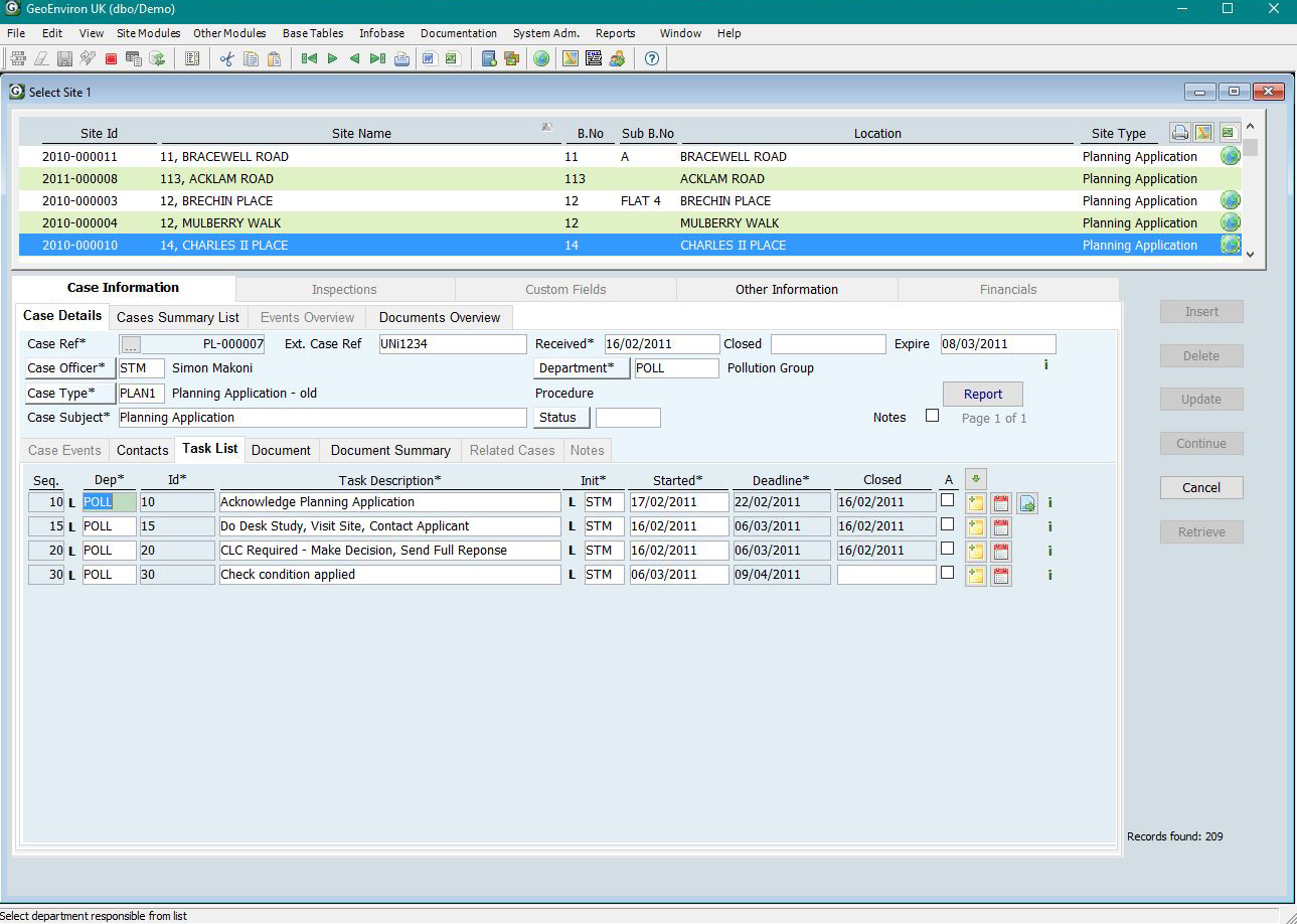
As well as recording information on their potential contaminated land sites, Fife also use the Case Management features within the system to keep a log of their proactive workflows. “Every task, be it a desk study, an intrusive investigation, an enquiry response or a planning consultation, is entered into GeoEnviron as a ‘Case’ and attributed to one of our five officers. The GeoEnviron calendar controls the workload and provides an auditable record demonstrating successful meeting of targets by the team”. Reports able to be generated by the system include the numbers of cases that have been opened and closed within a given time period, whether deadlines were met, and even financial aspects of the case (such as the income generated through responding to environmental enquiries). Donald stated that “I also believe that it is important to open (and close) a ‘Case’ for every work package undertaken by the team. This has served us well in planning and in enquiry responses”. Moving forward, Fife is now in the process of retrospectively completing case records for strategic Part IIA work that they have undertaken.
Fife is part of the Contaminated Land Resource Sharing Group (RsG) along with Clackmannanshire and Perth & Kinross Councils. The RsG shares specialist equipment, officer-time and expertise, saving money and reducing the time taken to investigate potentially contaminated land. Each Council is now completing more investigative work than before the RsG was set up in 2011 and when boreholes are drilled within Fife, the Survey Module within GeoEnviron is utilised to record information on the location of the boreholes. This can then be directly linked back to the site record within the Investigation Module as well as their GIS.
At STM Environmental, we pride ourselves in our relationship with our clients and ensuring that the transition from the previous system to ours is straightforward and stress-free. If any problems are encountered with the system, or additional support is needed to ensure that users are making the most use out of the system, we are on hand to guide you through the process and assist in any way we can. Donald highlighted this by saying “the main advantage for me of using GeoEnviron is that our existing data was imported by the supplier directly into the correct place within the new system, and that any problems or perceived shortcomings were addressed promptly”. At STM, we are also always looking to improve the functionality of the software and therefore rely on feedback from our users to indicate what they would like the software to be able to do.
A final comment from Donald: “Contaminated Land is probably unique in its dependence on GIS for diverse historical information. GeoEnviron and MapEagle have been envisioned and created by someone who works in the industry and this is apparent in the construction of both systems.”
Ensuring that information is stored in a complete and robust system is important for all local authorities to maintain and improve their current data, make the most efficient use of officers’ time, and decrease liabilities. Fife have illustrated how a comprehensive system has assisted them in managing and improving their records, both of potential contaminated land and proactive workflows, and this is an example of how local authorities can benefit from a well-managed, purpose-built contaminated land data management system.