Phone : 0800 470 3410
Phone : 0800 470 3410
East Hertfordshire Use the MapEagle GIS Report Writer to Provide a Rapid Environmental Screening Search Service for Planning Applicants
Written in collaboration with Cerys Williams (Senior EHO) at East Hertfordshire District Council
Cerys Williams, Senior EHO with East Hertfordshire District Council (East Herts DC) is a contaminated land specialist who has been using STM Environmental’s MapEagle GIS Report Writer for her work since 2008. Although Cerys also uses MapEagle to produce environmental searches for homebuyers and consultants, it is the innovative use of MapEagle to help planning applicants put together their own land contamination screening assessments that really caught our eye.
Using MapEagle, Cerys is able to supply information in the form of a MapEagle report that applicants can use to support their planning application for small scale sensitive development of green-field or residential land. A small fee enables the service to be self-financing.
Land contamination is of course a material planning consideration and it is the developer’s responsibility to identify land affected by contamination and to ensure a safe development. Guidance suggests that, because of the widespread potential occurrence of contamination, the possibility should always be considered, regardless of past land use, when development is proposed involving or introducing a particularly sensitive end use such as allotments or residential development. Many authorities, including East Herts DC, therefore require applicants to submit a preliminary land contamination assessment for sensitive development.
For large scale brownfield developments where there is a known history of potentially contaminative use, the Council will normally expect a Phase 1 desk study as a minimum. But, for small scale sensitive development, automatically requiring such a study can often be disproportionate, particularly on a green-field site or where the land is currently used for housing. East Herts DC is mindful of the potential cost implications of a formal land contamination assessment and investigation. Applicants for small scale sensitive developments on existing residential or green-field sites are therefore required to complete and submit a short questionnaire along with their application. The information in the questionnaire helps East Herts DC to assess whether a more formal assessment/investigation of land contamination is needed.
East Herts DCs Land Contamination Assessment Questionnaire” includes questions relating to fuel, chemical and waste storage on site, location of services and any knowledge of filled ground. In order to complete the questionnaire, however, applicants need to have completed a historical map analysis to identify existing and previous industrial uses in the vicinity of the development, including information about landfills. Typically, applicants (or consultants) might use one of several national environmental search services to supply such information. This is where Cerys and her expertise, aided by MapEagle, is an invaluable resource for East Herts DC. Using MapEagle, Cerys can supply a comprehensive environmental search within 3 days of a request. Reports include a brief analysis of the data and it is this as much as the supporting data that the applicant needs. The applicant gets a comprehensive document to submit along with their application at a reasonable cost which also incidentally supplements the income of the local authority. All parties also know that the information is up to date and relevant as it provided by the same team that will help assess the application. A real win-win.
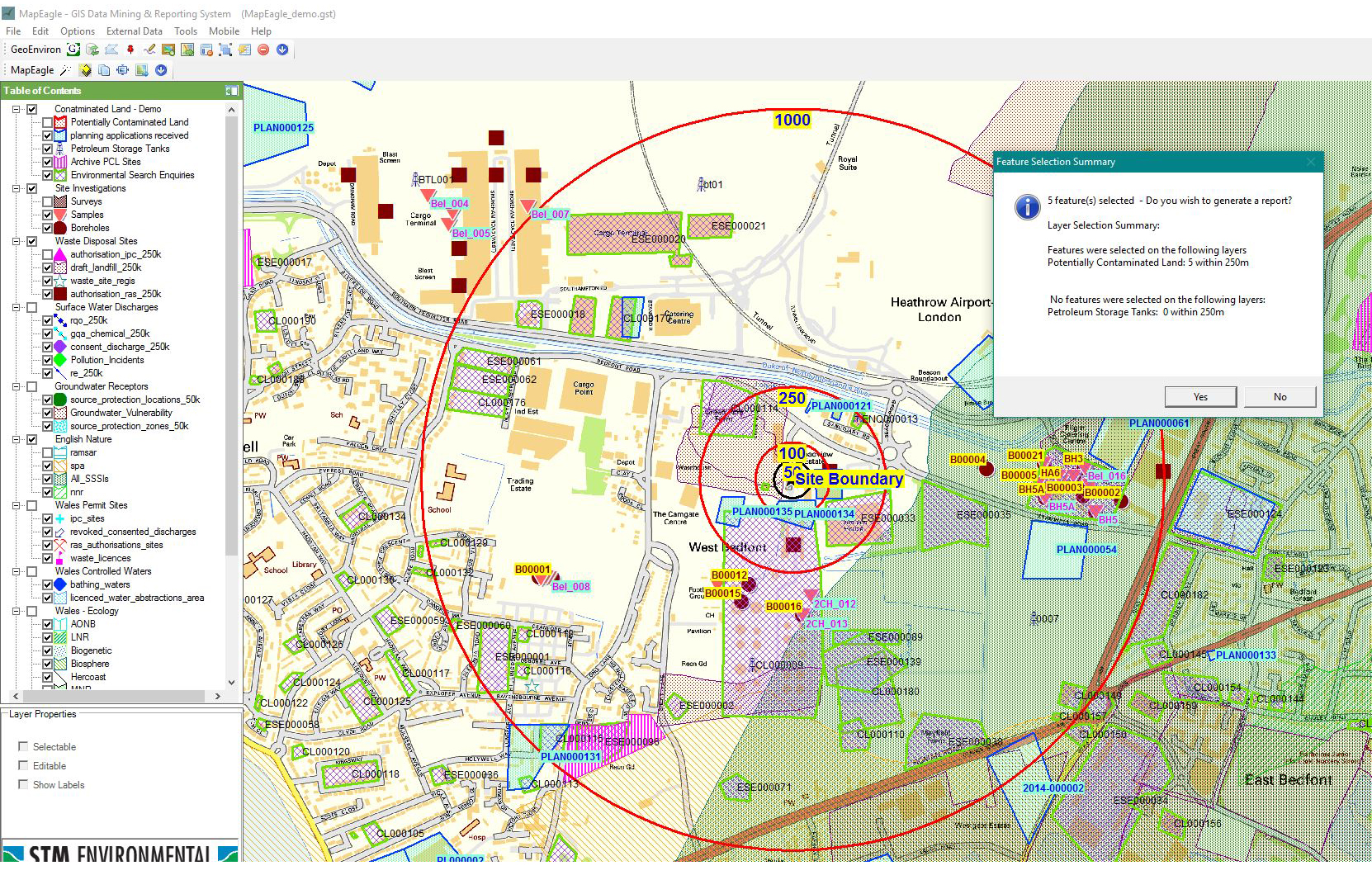
As in most local authorities, the environmental health team at Herts DC hold a range of valuable GIS layers including potentially contaminated land and landfill data. They also have access to digitised historical mapping. A lot of work has often been undertaken to ensure that this information is current and organised within their GIS such that the authority can fulfill their duties under Part 2A of the Environmental Protection Act 1990 as well as acting as internal consultants to planners. Using MapEagle, East Herts DC are able to automate much of the process of producing an environmental search report, adding value to the data that they hold and promoting their service. They can also reduce cost to planning applicants by providing exactly the information the applicant needs at an affordable cost.
When Cerys gets a report request she digitally draws the proposed site boundary against current-day GIS mapping in MapEagle, enters some basic details about the application and then just waits for the report writer to run. Cerys estimates each initial report takes about 5 minutes, including identifying the site on the map and waiting for the Word document to be produced. Cerys can then review the output and add her own comments before saving the finished report in pdf format for e-mailing or printing. Reports can include maps showing the proposed site boundary against a range of current and historical mapping, together with data and explanatory text from any number of GIS layers.
All local authorities are looking to improve efficiency, making the most of existing resources such as information and expertise. East Herts’ innovative use of the MapEagle GIS Report Writer to provide environmental searches for planning applicants is an excellent example of how local authorities can do positive work in financially difficult times.